

Climbers Guide: Annapurna IV or Annapurna 4, 7525M

Annapurna IV, false summit 7300 and real summit 7525M (middle top)
MOUNTAIN OVERVIEW
Name: Annapurna IV or Annapurna 4 (Link)
Elevation: 7525M/24688FT
Co-ordinates: 28°32′15″N 84°4′58″E
Crowd level: Minimum (Spring/Autumn, 0 - 20)
Difficulty grading: TD+/4 (Alpine/Fitness grading info)
Location: Annapurna region. Humde, Manang.
Parent Mountain: Annapurna massif
Acclimatisation Rotation: 1 rotation
Camps: 4 high camps
Summits: 1 Fore Summit / 1 Main Summit
Country: Nepal
ABOUT THE MOUNTAIN
Annapurna IV, standing at 7,527 meters, presents an ideal mountaineering challenge for climbers seeking a rewarding ascent with manageable technical requirements. Situated within the renowned Annapurna massif range, it occupies a prominent position between Annapurna II (7,937 meters) to the west and Annapurna III (7,555 meters) to the east.
Unlike its neighboring peaks, Annapurna IV offers a climbing route with fewer inherent dangers and a semi-technical nature, making it accessible to climbers with moderate experience levels. Within the Annapurna massif range, it is recognized as the least perilous and least technically demanding summit.
Despite its exceptional attributes, Annapurna IV remains relatively less frequented compared to other peaks in the region. However, its allure lies in its lesser-known status, offering climbers the opportunity for a unique and memorable ascent amidst the breathtaking Himalayan landscape.
HISTORY
Annapurna IV was first climbed in 1955 by a German expedition led by Heinz Steinmetz via the North Face and Northwest Ridge.
HOW TO GET HERE?
There is one main route to get to Annapurna IV Base Camp.
Via Humde village, Manang
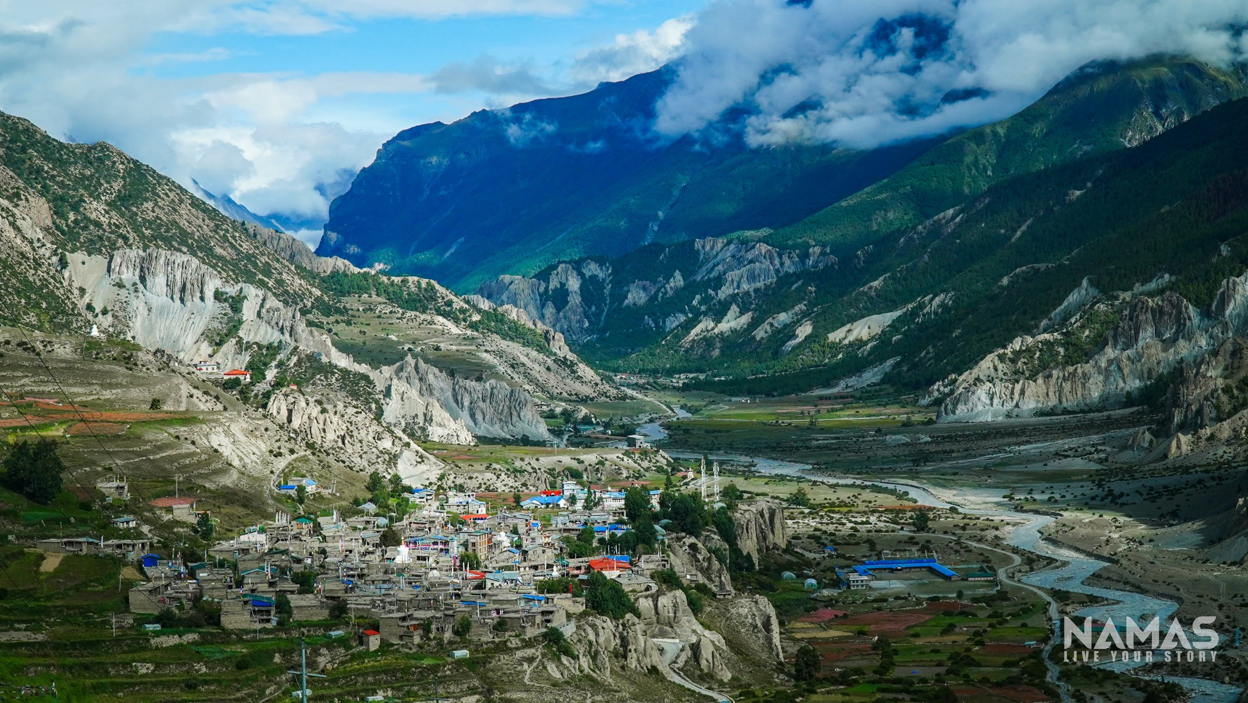
Manang village, acclimatisation hike 3519M
Route to Annapurna IV Base Camp 4800M - 4850M
We highly recommend an acclimatization trek to Manang village at 3,519M, before hiking up to the AIV base camp. Climbers will navigate through lush pine forests and uphill terrain heading toward base camp. Climbers will have to hike up the steep hill and moraine to reach the Annapurna IV base camp situated at 4,800 meters.
Set against the backdrop of the majestic Annapurna massif, the Annapurna IV base camp offers a picturesque setting with panoramic views of Annapurna II, IV, and III. The flat surfaces of the hill provide ample space for setting up multiple camps, while nearby glacier lakes and streams serve as reliable water sources for expedition use.


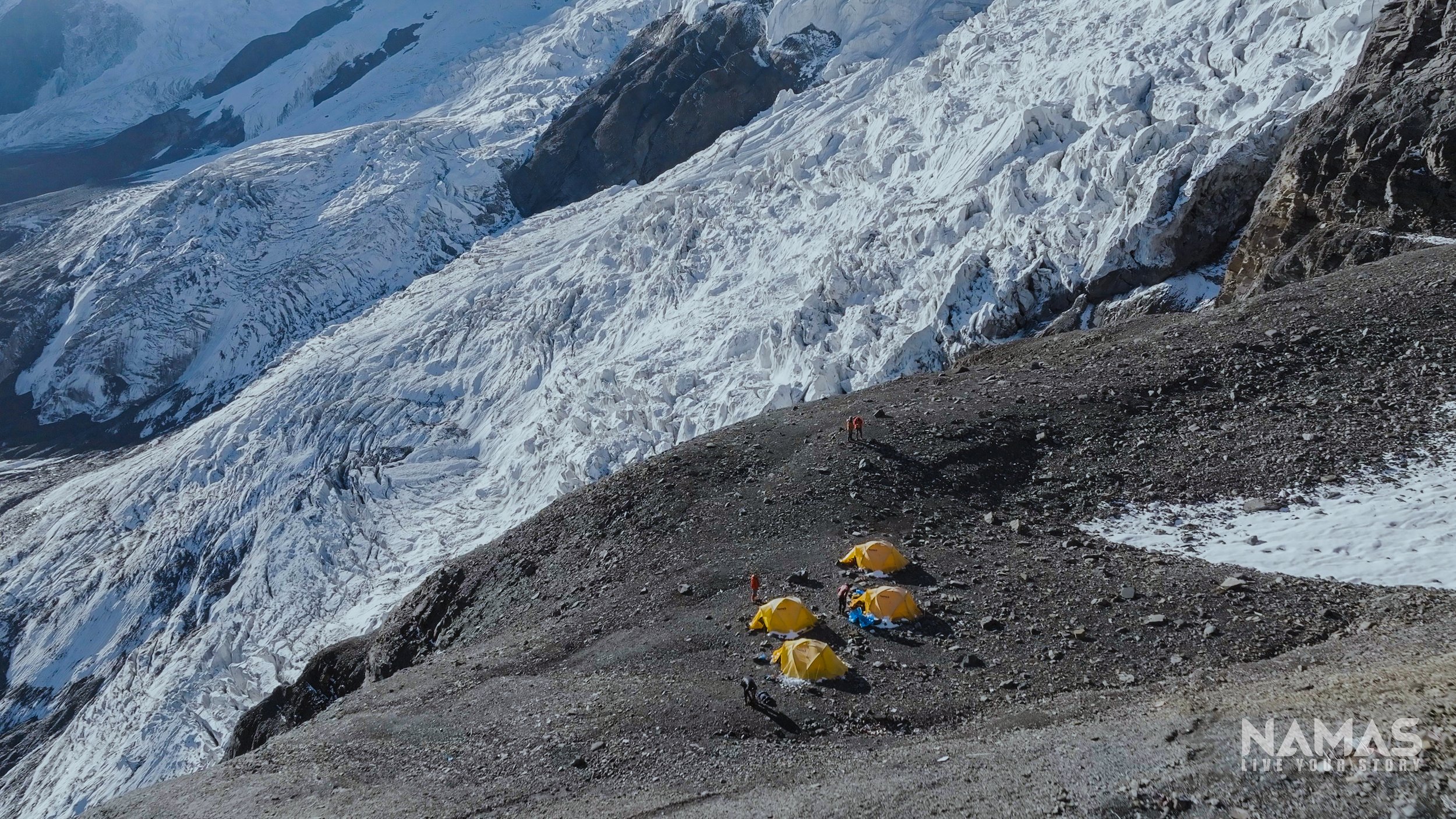
Annapurna IV, Base Camp, 4800M - 4850M
Route to Camp 1 5500M. 5 - 7 hours
Traversing the moraine glacier, climbers will ascend to the base of the mountain. The journey to Camp 1 entails a challenging ascent up a steep, rocky slope. To assist climbers, a fixed line will be established by the team, facilitating vertical climbs with inclines ranging from 60 to 80 degrees on sharp rock slabs. Negotiating this rugged terrain involves scrambling, jummaring, and traversing exposed sections of the mountain—a crucial initial technical phase of the ascent.
Expeditions conducted during the spring season should anticipate encountering a substantial amount of snow compared to expeditions in autumn.


Camp 1, 5500M
Route to Camp 2, 5500M - 5600M. 5- 6 hours
The ascent to Camp 2 commences with a challenging uphill climb of loose rocky terrain before climbers reach a designated crampon point. Here, team members secure their crampons in preparation for an 80-degree steep climb across icy and snowy terrain.
Climbing towards camp 2, the route carefully avoids areas prone to avalanches, it skirts the left side of the mountain, where avalanche activity is more common. Despite initial apprehensions, climbers can rest assured that the climbing route is designed with safety in mind and is not susceptible to avalanches. Although a few crevasses may be encountered along the way, they are manageable, either by navigating around them or making calculated leaps across. It is essential for climbers to remain securely attached to the fixed line throughout the ascent.
Offering breathtaking views of the Annapurna wall and the expansive glacier, this climb presents a picturesque and rewarding experience amidst the awe-inspiring scenery of the Himalayas.


Annapurna IV Camp 2 (5500M - 5600M)
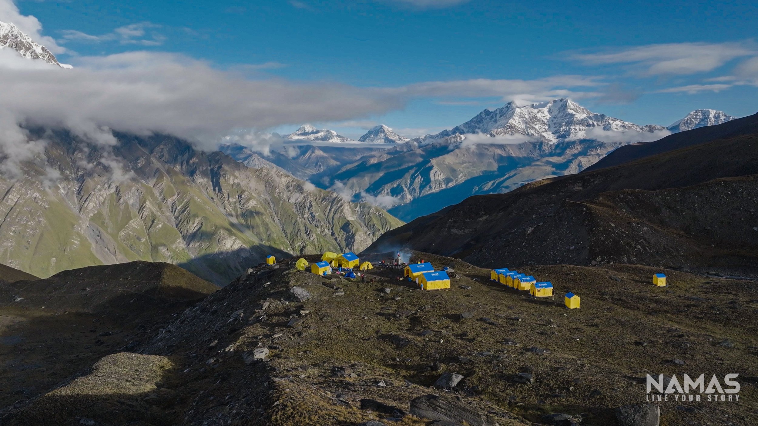
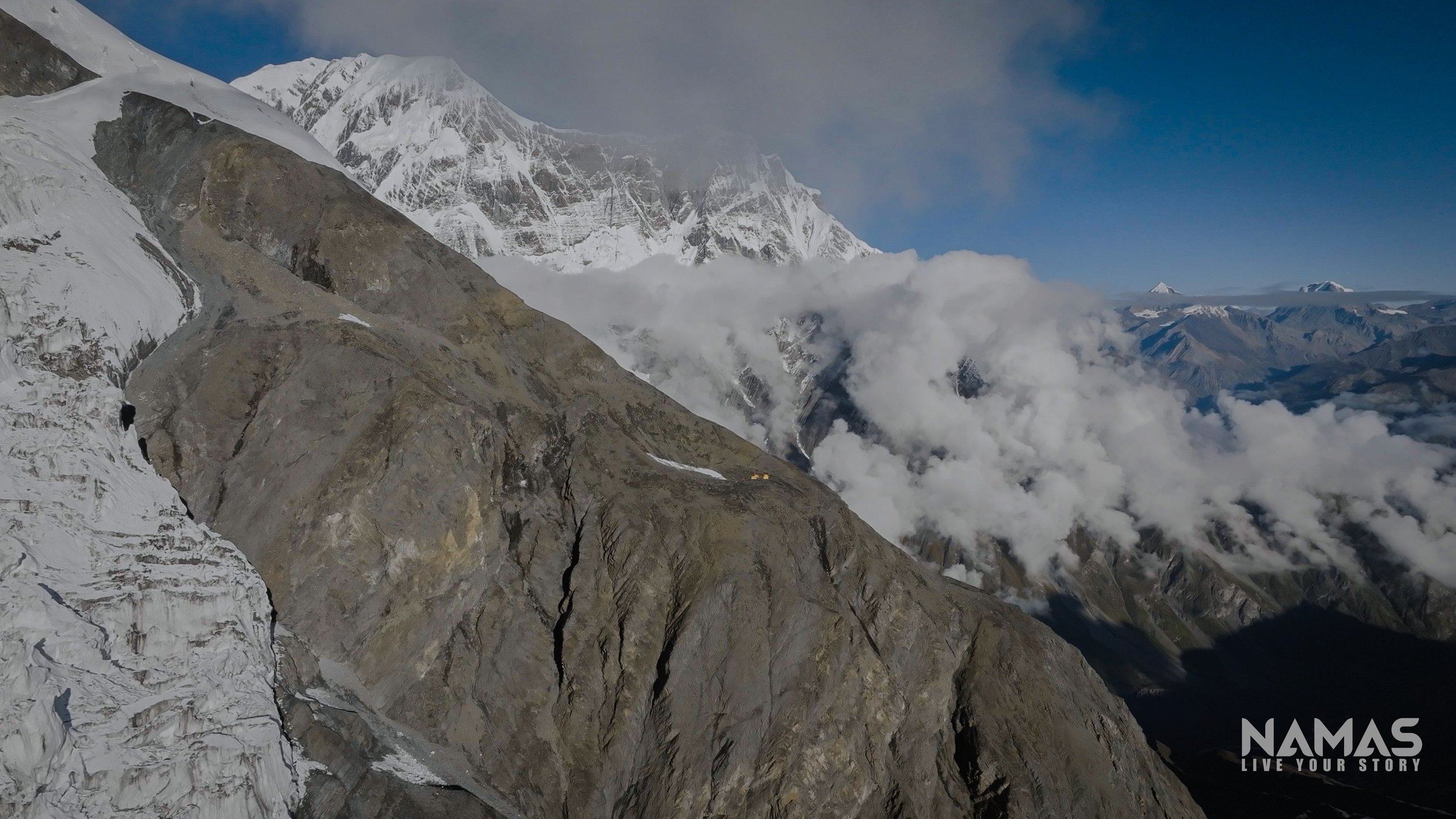
Camp 2, 6500M
Situated on a compact, level expanse of the mountainside, this camp offers protection from strong winds originating from the north and northeast sections of the mountain range. Prepare to be captivated by the breathtaking panorama unfolding before you. From this vantage point, the majestic peak of Manaslu, towering at 8,163 meters, commands attention in the distant horizon. Additionally, the formidable wall of Annapurna II dominates the landscape, extending far into the leftward vista, where the impressive silhouettes of Himchuli and the Chulu ranges adorn the skyline..

View from camp 2. Annapurna II 7937M and Manaslu 8163M in the far distant.
Route to Camp 3 (6 - 7 hours)
Upon departing from Camp 2, climbers will immediately face a challenging ascent up the headwall, marked by a steep incline. Following the climb past two prominent boulders, climbers will encounter a sizable crevasse directly ahead. While manageable, this crevasse presents a notable obstacle, with plans for ladder crossings in future expeditions should the opening widen.
Upon successfully navigating the crevasse and ascending another incline, climbers will find themselves traversing across a vast expanse of snowfield. After approximately 1.5 to 2 hours of rigorous climbing, Camp 3 comes into view, offering a welcome respite amidst the stunning mountainous terrain.


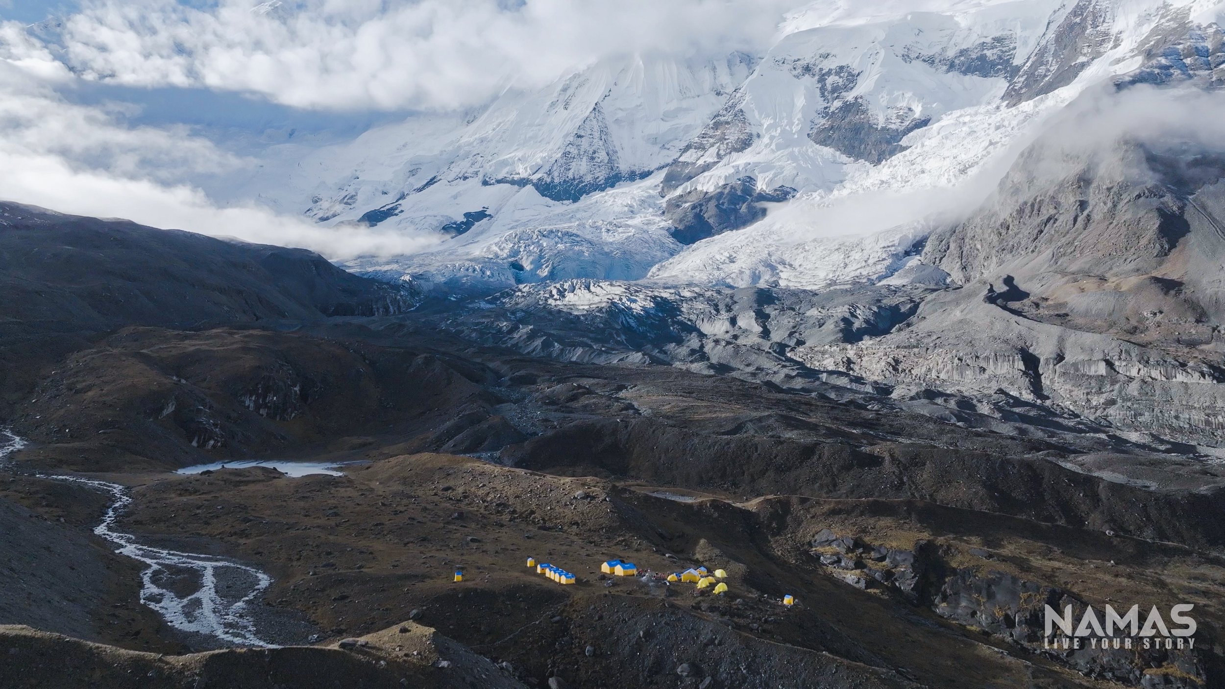
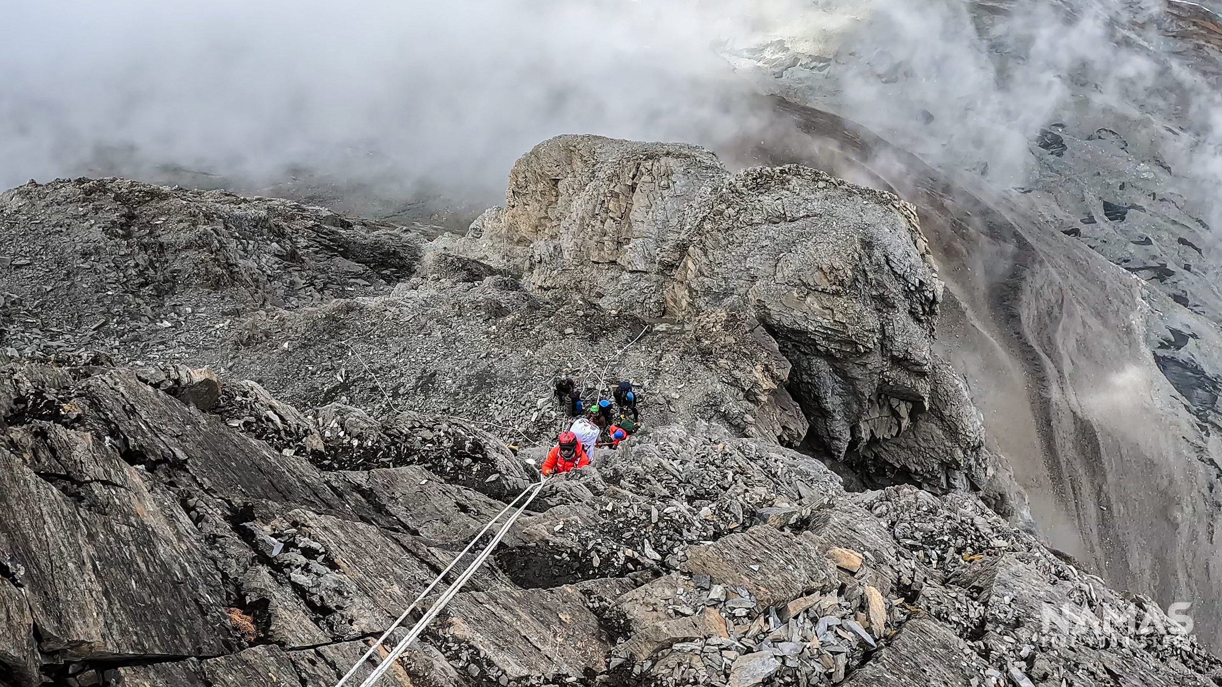
Camp 3, 6600M
Positioned on the expansive shoulder of the mountain, Camp 3 offers 360 views of the surrounding mountains. Fishtail (Machhapucchre) mountain is directly to the north-east along with Annapurna 1 and south. With a sweeping view of a significant portion of the mountain directly ahead, climbers have the option to strategize their summit route either along the mountain's slopes or via its southern aspect. Given the complexity of this vast slope and the absence of marked routes typical of more commercialized mountains, the presence of experienced leaders and skilled route setters is imperative.
Navigating this terrain demands a high level of expertise, as the route may not be easily discernible, and few climbers are likely to traverse it. Additionally, certain areas may pose a risk of avalanches, underscoring the importance of proficiency in navigation and avalanche detection. With the guidance of seasoned professionals, climbers can confidently navigate the challenges of Camp 3 and proceed with their ascent toward the summit.

Annapurna IV Camp 3 6600M

The chaos to navigate to make it to the summit.
Route to Camp 4, (6 - 8 hours)
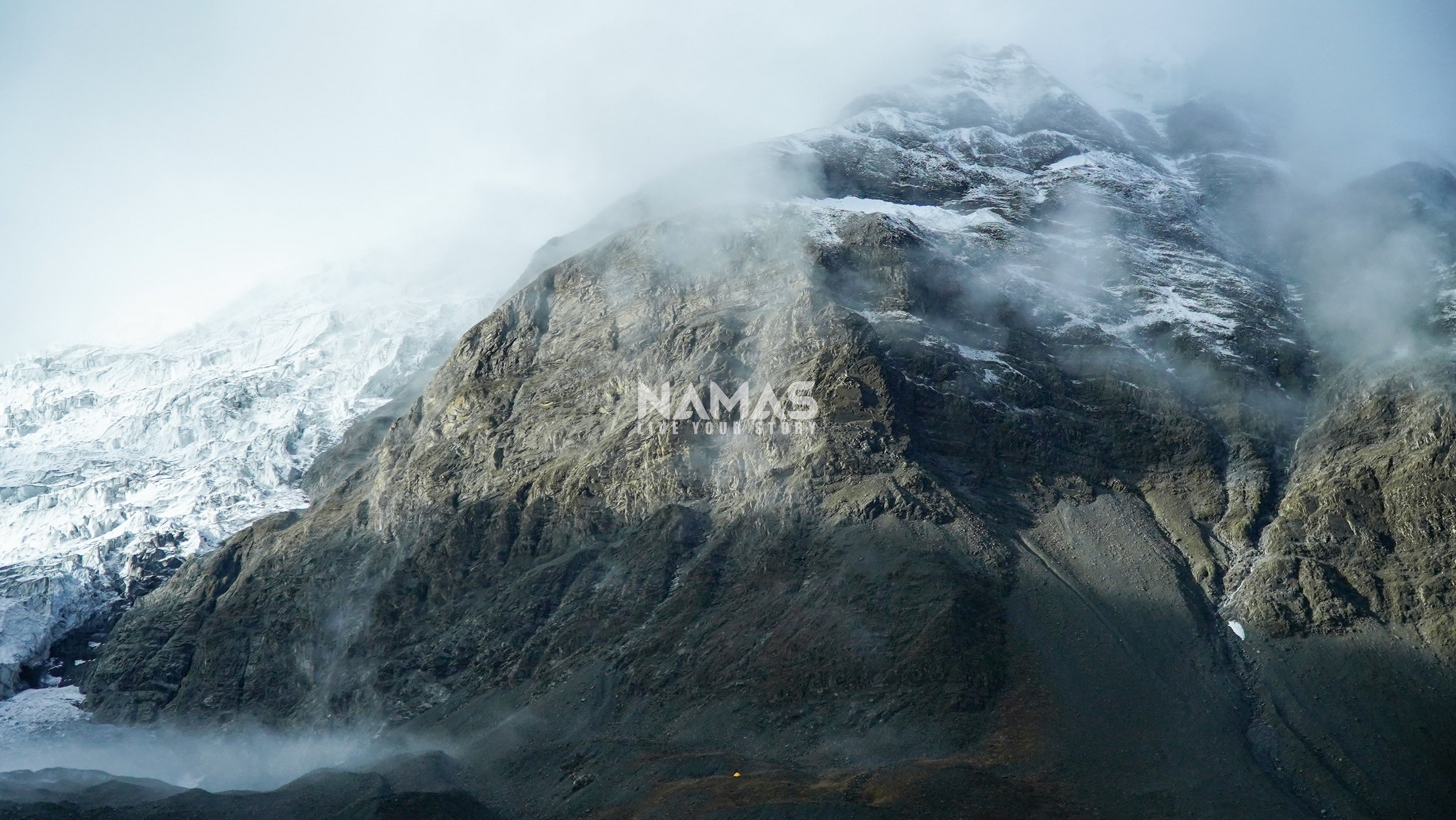
Embarking from Camp 3 towards Camp 4 involves traversing snowy fields and negotiating uphill slopes before descending across snow fields. The subsequent grueling ascent presents a continuous uphill climb toward the mountain's shoulder, requiring precise navigation skills from route setters.
This route offers teams two challenging options: a direct push to the summit from Camp 3, with an overnight stop at Camp 4 on the return, or a camp at Camp 4 followed by a summit push before returning to Camp 3. Camp 4, positioned at 7000 meters altitude on a flat surface, demands extra caution due to potentially windy conditions.

Camp 4 can be on the setup on the shoulder (middle) of the mountain.
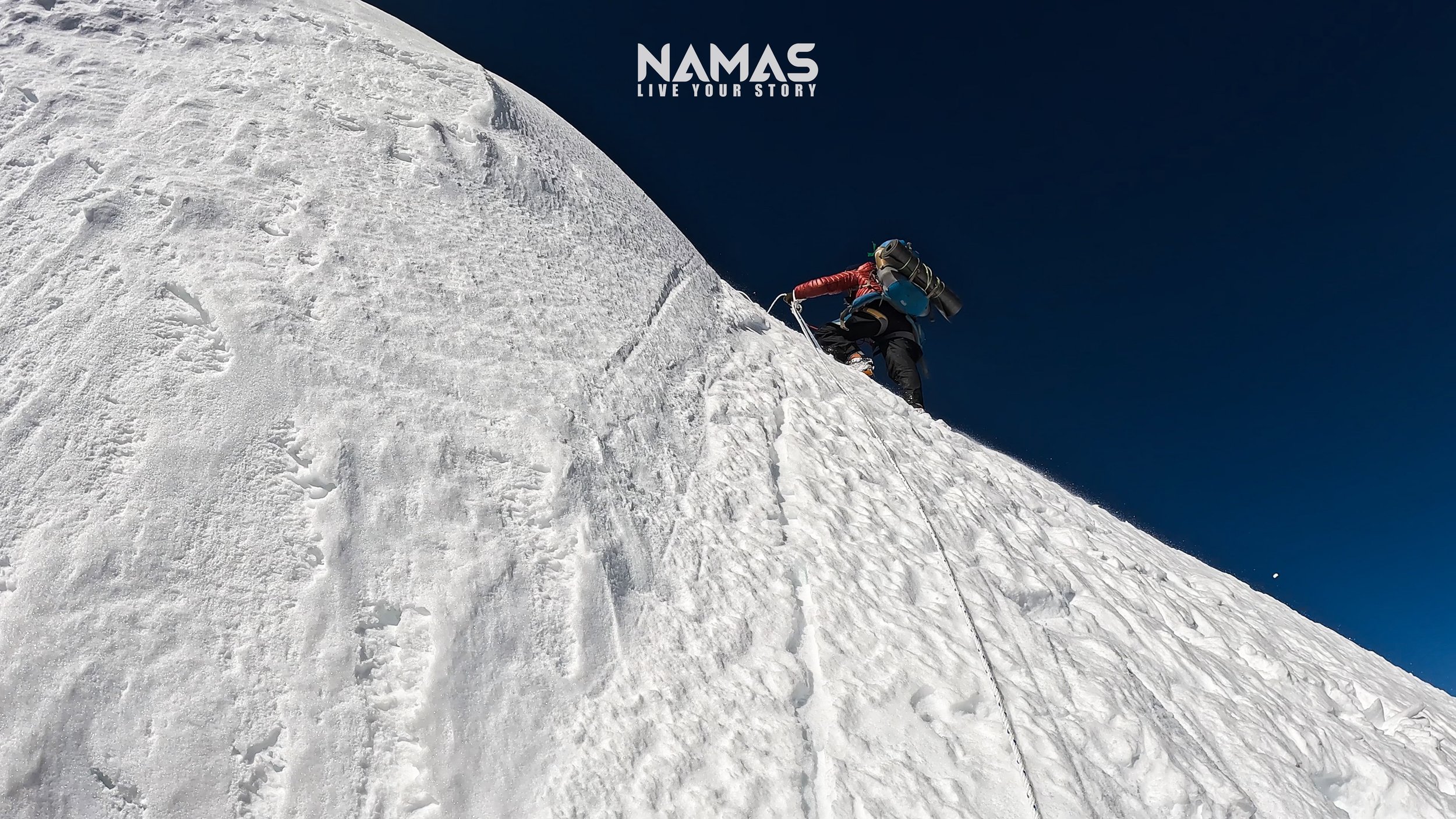
true Summit of Annapurna IV 7525M to Camp 4 (7000M). 10-12 Hours
Climbers need to prepare themselves mentally for a lengthy, steep, and arduous journey to the summit. The ascent from Camp 3 to the summit and back typically spans 12-14 hours. Following departure from Camp 3, climbers face a daunting 1000-meter climb characterized by its steepness and length, making it a formidable challenge.
Safety measures include the installation of fixed lines along perilous and overhanging sections of the mountain walls. Weather permitting, summit views offer a breathtaking panorama encompassing the entire Annapurna massif range, including Annapurna I, II, III, Gangapurna, and Tilicho Peak, as well as prominent peaks like Manaslu (8163 meters), Machhpucchre, Ganesh Himal, and Dhaulagiri.
Upon completion of the summit, the objective is to return safely to Camp 4. Camp overnight, rest for a night and then an early downhill morning to base camp, which is expected to be a long 8-10 hours descend from the mountain, bringing our expedition to a conclusion.


Namas Adventure team members at Annapurna IV 7525M true summit. This one will be for life time memories. What a climb and pure test of grit, will and mental toughness.
Watch full Annapurna IV 7525M Expedition video
Feel inspired to embark on a 7525M remote expedition with not many climbers? Let us be your guide to remote mountain peaks in the Himalayan region, including the challenging Annapurna IV at 7525 meters. Our specialized team excels in safely accessing and navigating these pristine mountain territories, opening up new possibilities for exploration and discovery.
Visit our website for more information on our Annapurna IV expedition and our range of international expeditions. For booking inquiries, reach out to us at bookings@namasadventure.com.
Unleash the explorer within you, and climb where less has been.
LIVE YOUR STORY - NAMAS ADVENTURE TEAM